

 O-Sense
طراحی مسیر حفاری | Well Seeker PRO 1.4.3
![]()
نرم افزار Well Seeker PRO محصول شرکت Innova Drilling and Intervention نرم افزاری با توانایی بالا در زمینه طراحی مسیر حفاری و مدیریت اطلاعات survey می باشد و برای شرکتهای تجاری، کارفرماها و DD من ها پکیجی قدرت مند می باشد. این نرم افزار با ترکیب قدرتمند طراحی 2 بعدی و 3 بعدی به همراه دیتابیسی قدرمتمند به کاربر این امکان را می دهد که به سرعت و به آسانی به مسیرهای حفاری طراحی شده و محاسبات anti-collision دسترسی پیدا کند. این نرم افزار یکی از جدیدترین نرم افزارهای حفاری جهت دار به حساب می آید.
بررسی نرم افزار Innova Well Seeker PRO:
Software Overview
Well Seeker PRO is a high performance well planning and survey management package designed for use by Directional Drilling Contractors, Operators and Well Engineering Companies. The software integrates high performance 2D & 3D graphics with a powerful database engine that allows the user to easily store and visualize their well trajectories as well as perform complex well planning and anti-collision calculations. Well Seeker PRO offers exceptional performance at a competitive price with all the features expected of an industry leading well planning package.
Directional Well Planning Module:
- Full range of easy to use 2D & 3D well planning methods including:
- Dogleg Tool Face
- Build and Turn
- Optimum Align using Curve-Hold-Curve or Curve-Curve
- Line up on Target at specified inc / azi
- One click S-Well and Slant Well construction
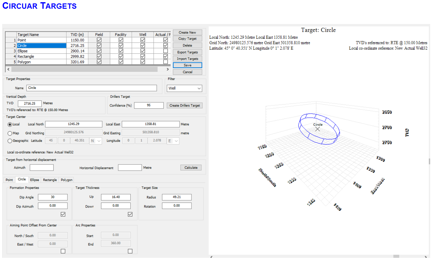
- Simple 2D circular and Elliptical
- Point & Rectangular
- Complex 3D multi point Polygonal
- Supports multiple target geometries including:
- •Create Drillers Targets based on error models, well trajectory & required confidence
- •Supports advanced well planning for all applications; from simple vertical exploration wells to complex multi-laterals
Anti-Collision Module:
- Perform anti-collision scans using industry leading proximity detection algorithms
- Calculate ellipse of uncertainty (EOU) using full range of ISCWSA MWD and Gyro error models
- Error outputs and Centre to Centre distances validated against ISCWSA standard well paths to < 0.1% error
- Anti-collision scans can be run interactively during planning and drilling phases on multiple actual wells / plans
- User defined warning criteria and alerts can be set to notify of potential collision risk
- Casing and hole diameters can be included in separation factor calculation in order to increase accuracy. Especially important for top hole drilling with large diameter surface casing.
- Ability to create custom Instrument Performance Models (IPM)
- Error output sigma level can be selected by the user
- Advanced anti-collision visualisation tools available including:
- Ladder Plot
- Separation Factor Plot
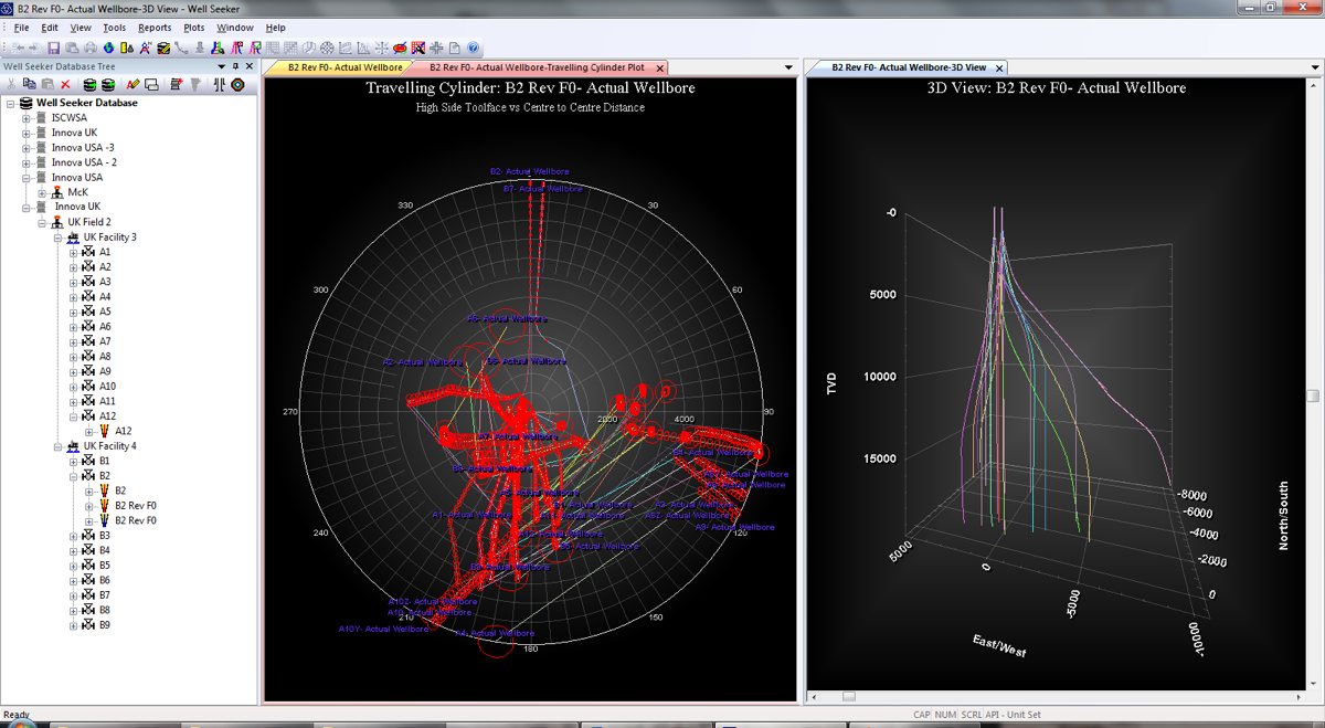
- Travelling Cylinder Plot
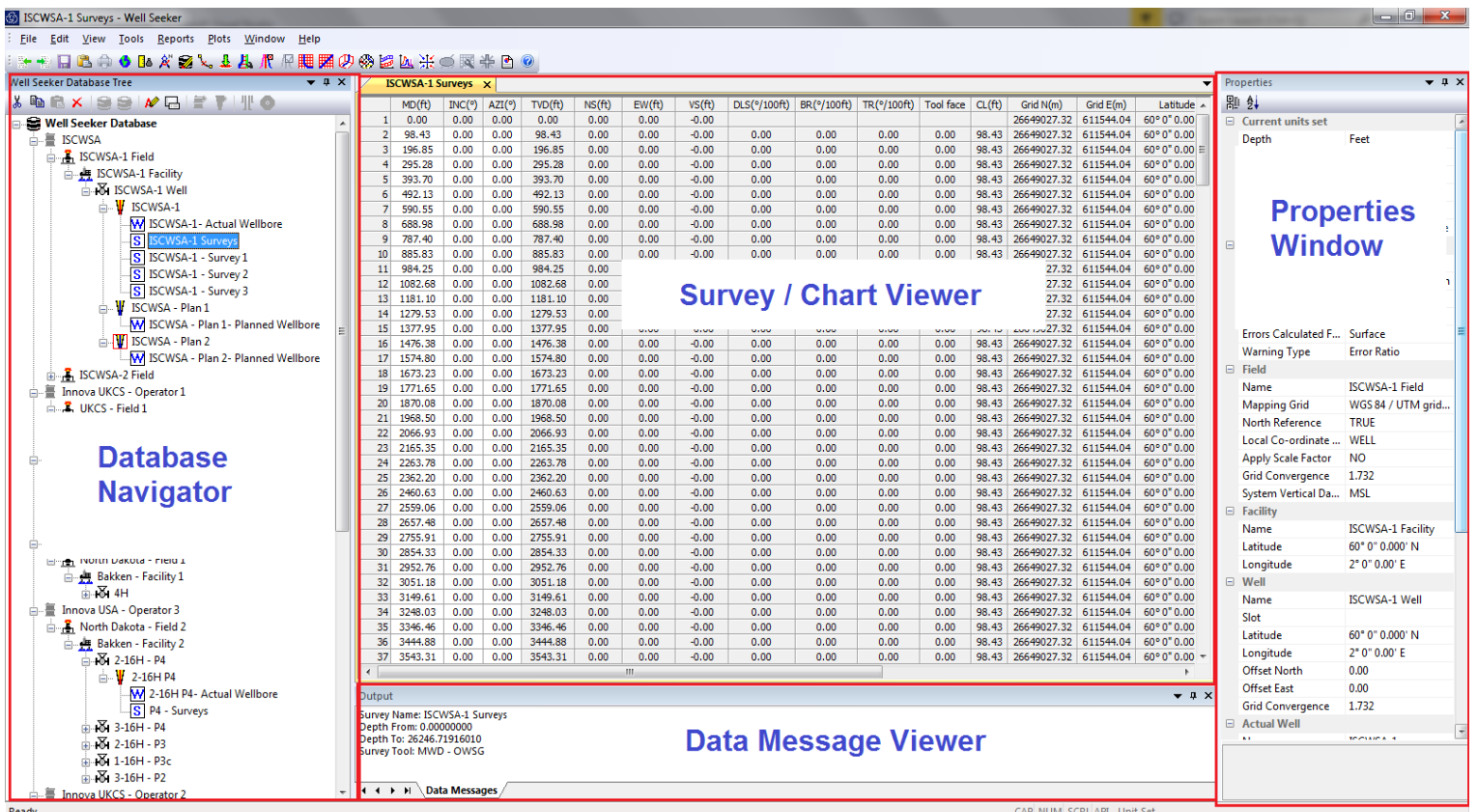
Powerful database:
- Built on a powerful database engine which allows storage and navigation for an unlimited number of actual wells and plans
- Easy navigation of database through familiar tree view
- Import and export of data allows easy transfer of wells and plans from office locations to the field
Wellbore Visualization:
- Fully customisable, advanced and powerful 3D plotting capability
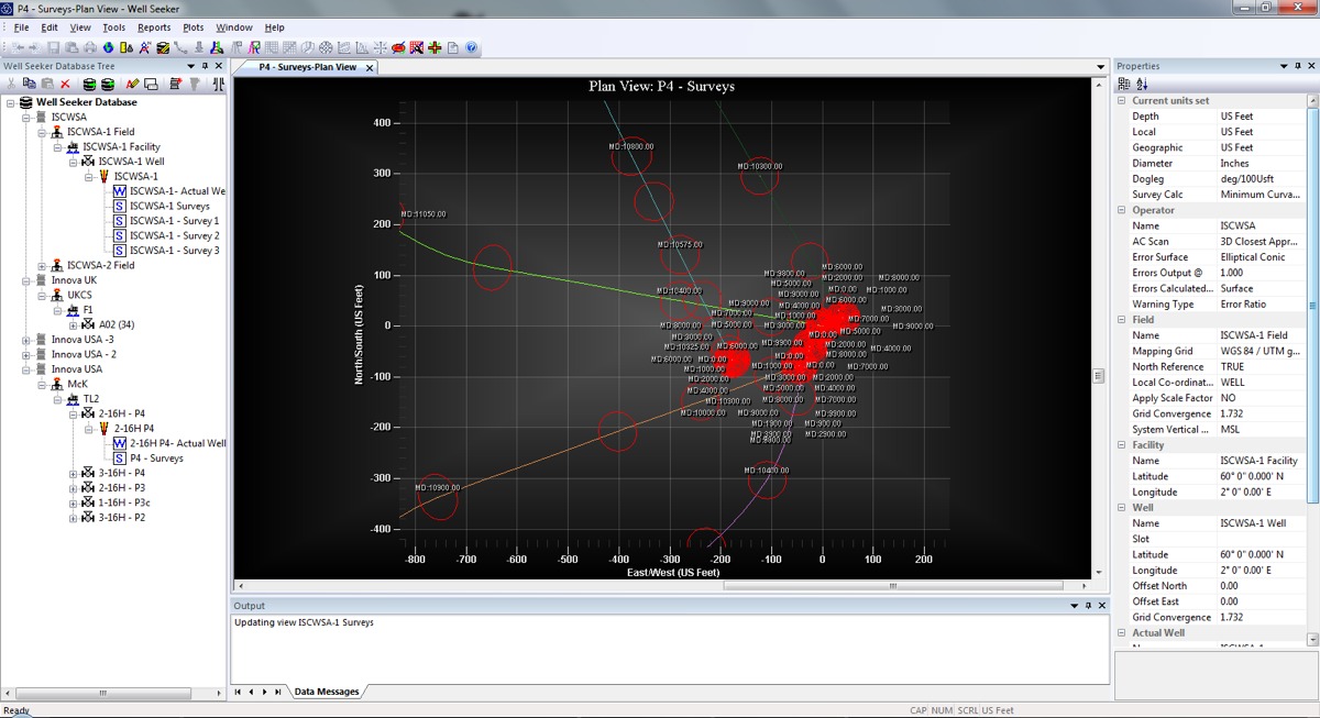
- Plan View (Top Down) Plot
- Section View (Side On) Plot
- 3D Plot
- Spider Plot with interactive TVD slice control
- Azimuth Comparison Plot (Azimuth vs MD)
- Inclination Comparison Plot (Inclination vs MD)
- Dogleg Comparison Plot (Dogleg vs MD)
- Print directly to multiple image formats including PDF / jpg / bmp / png.
- Copy directly to clipboard allowing images to be quickly added to word, excel & PowerPoint documents
- Wall Plot Composer (WPC) allows the user to create customisable wall plots which can include data tables.
- Pre-defined plot sizes range from A0 to A7 with a user defined option also available.
Geomagnetic Modelling
- Includes World Magnetic Model (WMM) and International Geomagnetic Reference Field (IGRF) model as standard
- Supports British Geological Survey Global Geomagnetic Model (BGGM)*
*available only to full BGGM license holders
- Supports High Definition Geomagnetic Model (HDGM)**
**available only to full HDGM license holders
Reporting
- User defined reports include:
- Standard Survey reports
- Geographic Survey reports
- Anti-Collision reports
- Ellipse of uncertainty (EOU) reports
- Exports to fully customisable PDF and Excel reports
تیم PetroTools این نرم افزار را برای شما ارائه می دهد. جهت تهیه نرم افزار با استفاده از منوی خرید با ما در تماس باشید
For buy software, Please contact us via buy menu